Introduction - Real Life Scenario
Click to Enlarge Image
You’re stuck behind a slow moving truck on a long stretch of a two-lane highway. The dashed centerline indicates that it’s safe to pass, and you edge left to see beyond the 18 wheeler. Your pulse quickens as you decide to go for it and press the gas. A car appears somewhere ahead, and you speed up even more. You clear the truck, quickly return to your lane and are thankful the harrowing ordeal is over.
Introduction
We’ve all experienced such passing anxiety, and whether we realize it or not, when faced with the decision to pass we are essentially stressing over the question of how accurate the passing zone markings are. Did they get it right?
With human lives at stake, transportation agencies such as the Utah Department of Transportation (UDOT) concern themselves with this question on an onging basis as they go through their multi-year cycles of refurbishing, repaving, and restriping their roads.
Conventional Passing Zone Studies
According to the National Highway Transportation Safety Administration (NHTSA) approximately 95% of US car crashes are caused by human error.
DOTs are continually spending money to restripe their roads as part of their regular multi-year road maintenance cycles. Restriping can include Passing Sight Distance (PSD) studies, particularly in areas where crashes and incidents have been occuring more frequently. Considering the fact that passing a car on a two-lane highway is highly dependent on human factors, we might expect that the methods for determining where it is safe to pass, i.e., passing zone studies, would employ the most recent techniques and technologies. Regretfully, this isn’t the case.
How It's Done Today?
Present day passing zone studies are usually carried out by two vehicles driving in tandem at a pre-calculated distance deemed safe for passing. The trailing car represents the passing car, and the lead car represents oncoming traffic. The cars travel along the entire route in question and areas where the lead car is visible to the trailing car are considered safe for passing. Said another way by a reputable engineering firm, the common method of conducting passing zone was described as follows: “Currently, the established method is to estimate passing zones by driving the corridor with two vehicles to determine where passing sight distance is available and where it is not.”
The Challenges
As you can imagine, this method has many challenges, both from a safety perspective and from a DOT’s economic perspective. Some of the challenges include:
Labor – Current models require you to physically traverse each mile in the study.
Cost – Conventional passing zone studies are charged by the mile, and with human involvement, can be quite costly.
Limited Scope – Because of the expensive and limited resources involved, it is not economical to do such studies across all road sections. While many sections may not require studies, it is likely that amongst the thousands of miles under a DOT’s responsibility, some sections that should be analyzed will be passed over and some other basis will be used for striping, such as maintaining the existing striping.
Rapid Obsolescence – Passing zone studies can become obsolete because of changes such as increased speed limits, changes in foliage, commercial growth, etc.
Reactive – DOTs usually run passing zone studies where crashes have already occurred, rather than using an proactive approach that predicts where crashes are likely to occur.
Inflexibility – The analysis is conducted using certain parameters, and it isn’t practical to redo a test with a different set of starting parameters or to run the analysis multiple times.
Maximum Speed, Unlimited Mileage, Cutting Edge
Technology, and Affordable - Like every DOT's dream car
While progress often occurs in small incremental steps, technology occasionally affords a giant leap forward. When it comes to passing sight distance studies, RDV’s Road Safety Audit 3D is a clear case of the latter. After years of collaboration with DOTs and other infrastructure professionals across the US and the globe, we at RDV are keenly aware of their safety related pains and needs such as those caused by traditional passing zone study analysis practices and tools. Road Safety Audit 3D is our response, bringing automation and 3D visual analysis to a cumbersome and manual, very low-tech process.
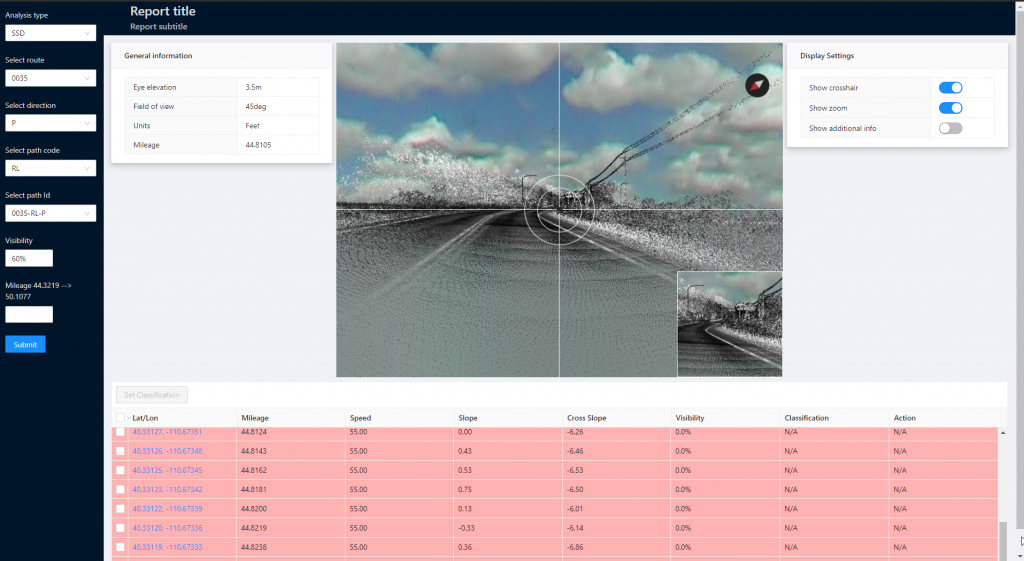
In the context of passing zone studies, RSA 3D couples LiDAR data of a road’s topography, or an existing 3D model with RDV’s best-in-class visualization engine, to simulate passing sight distance measurements at accuracy levels far beyond those of conventional methods. By using RSA 3D, DOTs gain substantial advantages that simply aren’t available with conventional passing zone studies.

Scalability
Analyze as many miles of roads as there is data for.

Affordability
Cost effective process that fits within any budget.

Speed
Results are generated in mere minutes, not weeks.

Flexibility
Ability to change variables as needed.

Repeatability
Ability to redo studies when conditions change.
A New Approach to an Old Problem
Earlier on, we explicitly mentioned the Utah Department of Transportation. UDOT has taken a strong interest in the RSA 3D suite of applications and has worked with RDV on a number of occasions. As UDOT is nearing the kick-off of a new resurfacing and restriping cycle for the many thousands of miles of roads under its responsibility, they are looking again to RDV to help them improve accuracy, reduce costs, and increase the scope of the passing zone studies included in this process.
To this end, UDOT engaged a third party to evaluate RSA 3D as compared to conventional two-car PSD analyses. Using UDOT’s LiDAR data, RDV analyzed several sections of road selected by UDOT’s safety team, and produced results that were found to correlate closely to conventional results.
The passing zones as determined by RDV do line up with the passing zones identified by the study.
From Evaluation Report

...using the LiDAR data may provide a more precise analysis and may result in less man-hours being used to complete a study.
From Evaluation Report
RSA 3D Technology in Action!
Play this video to experience a passing sight distance simulation on one of UDOT’s highways. Keep your eye on the ball – when it disappears it isn’t safe to pass.
Click to Play Video
LiDAR Data with Sight Lines - Examples
See RDV’s PSD Analysis of SR-150 in Utah in action! The green sight lines are an indication that it is SAFE to pass and the red sight lines are an indication that is NOT SAFE to pass.
Click to Enlarge Images


